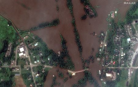
A satellite image shows the Winooski River and Winooski Street Bridge after the flooding in Richmond, Vermont, U.S., July 11, 2023. Maxar Technologies/Handout via REUTERS
A satellite image shows the Winooski River and Winooski Street Bridge after the flooding in Richmond, Vermont, U.S., July 11, 2023. Maxar Technologies/Handout via REUTERS